Services / 02
Surveying & Mapping
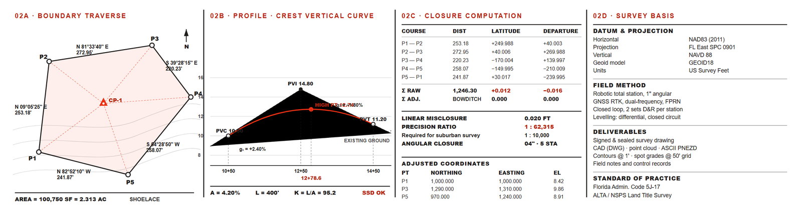
Measured ground, tied to control, delivered in the formats your consultants and reviewers can build from. You receive the signed drawing, the CAD files, and the field record and closure computation that stand behind them.
What the work covers
- Boundary retracement and topographic survey
- Construction layout with horizontal and vertical control
- Highway and infrastructure survey
- Site inspection and quality assurance
What you receive
- Signed and sealed survey drawing
- CAD deliverables and point cloud where scanning is in scope
- Elevation and contour data referenced to NAVD 88
- Field notes, control records and closure computation
How it is measured
Field first, office second.
Control is set on site, the ground is captured as it stands, and the observations are reduced in the office. Nothing is carried forward from an older drawing on the assumption that it was correct. What you receive is what was measured, and the closure computation travels with the drawing so you can check the work yourself.
Request a quoteOther services